No Products in the Cart


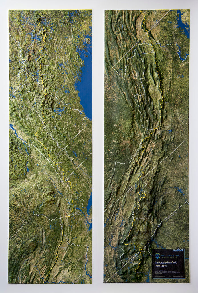
This raised relief map covers the entire Appalachian Trail, from Georgia to Maine. Using satellite imagery, the 3D map accurately shows the topography and geography surrounding the trail as it winds through the Appalachian Mountains. The state boundaries are marked, as well as key geographic features. The northern half of the trail is shown on the left side of the map, and the southern half on the right side. Anyone who has hiked the AT will appreciate this unique map. It is available unframed or framed in black aluminum, light or dark stained solid oak wood, or black painted wood.
Each raised relief map starts as a map printed on a flat study sheet of vinyl. It is carefully registered over a 3D model that is made from USGS digital elevation model data. The vinyl is heated to make it pliable and a vacuum is created to form the map over the model. Take a look at the process below.

This large map is available fully framed and ready to hang or unframed, perfect for pinning to a bulletin board.