• 800-248-6277
  • All Week From 9 AM To 5 PM CENTRAL
Denali National Park Three Dimensional 3D Raised Relief Map
  • SKU: ST0024C
  • Availability: in stock Many in stock Out of stock You can purchase this product but it's out of stock

Denali National Park Three Dimensional 3D Raised Relief Map

$169.99
Shipping calculated at checkout.
    DESCRIPTION

    Denali National Park Three Dimensional 3D Raised Relief Map

    • Scale: 1:401,000 (1" =6.3 miles)
    • Size: 24" x 20"

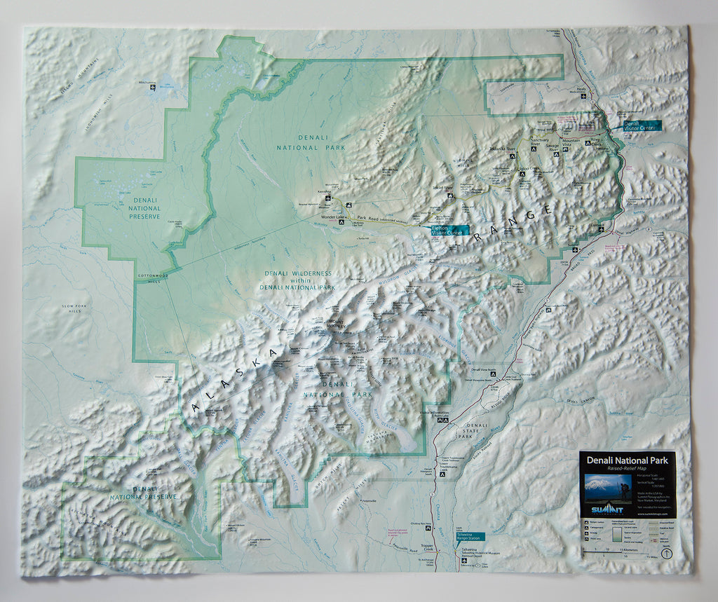
    This raised-relief map of Denali National Park shows amazing 3D detail of the dramatic Alaska Range mountains, glaciers, valleys and forests. The map centers on the 20,300' high Mt McKinley and shows the entire Denali park and preserve in precise raised-relief format. Measuring 24" by 20", with nearly an inch of vertical relief, this map is a unique and attractive tool for exploring the Denali area. Park visitors and outdoor enthusiasts will value this map for planning new trips to the park and recalling past ones. It is available both unframed (poster style) and framed (black aluminum, light or dark stained solid oak wood, or black painted wood).


    How are these three dimensional raised relief maps made?

    Each raised relief map starts as a map printed on a flat sturdy sheet of vinyl. It is carefully registered over a 3D model that is made from USGS digital elevation model data. The vinyl is heated to make it pliable and a vacuum is created to form the map over the model.
    Take a look at the process below.


    Framing options

    Framing options

    This large map is available fully framed and ready to hang or unframed, perfect for pinning to a bulletin board.


    Usually ships in 5-7 business days. Please allow additional 5 business days for framed options.
    REVIEWS

    RECENTLY VIEWED PRODUCTS

    BACK TO TOP